Sunday 25 August 2013

Coast to Coast to Coast Day 13 - High Bentham to Morecombe

Lovely sunset last night. We had a pleasant couple of hours sat around the camp fire chatting the evening away. Tomorrow is my last day on the route.
Sunset from Curlew Camp site.

Packed the bike and away from the camp site by 10.00, a nice relaxed day today with only about 20 miles to do. I deviated from the route, staying on the B6480 through Low Bentham and Wennington to rejoin the route at Wray.

Steps and Waterpump at Wennington.

Through Crook of Lune and along the bank of River Lune into Lanchaster, over the impressive Millenium Bridge which keeps cyclists and pedestrians away from the traffic.

The Millenium Bridge - Lancaster
 
Final 4 miles of quiet cycle lanes into Morecombe and along to the prom and the finish.

The Official Finish

The obligatory Eric Morecombe photocall

Cormorant Sculpture on the seafront.

Statistics for today:
Distance today 38.51km (23.9 miles)
Total Distance 663.7km (412.4 miles)
Height climbed 78m
Total height Climbed 7561m
Average speed 17.8km
Maximum Speed 53.6km

As my train home isn't until Saturday I've a bit of time to kill. So I'm heading along to a campsite at Bolton le Sands to relax.

Swallows on the telephone lines.

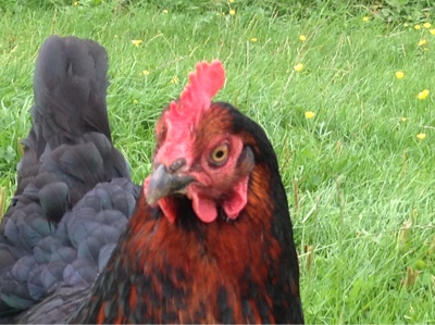
Ooh look girls, a cyclist.

Sunset over Morecombe Bay

It's been a great two weeks cycling firstly the Walney to Whitby Cycle Route then cycling along the North Yorks Coast from Whitby to Bridlington and finally Bridlington to Morecombe along the Way of the Roses Cycle Route. Total distance covered has been 412 miles. It's been quite relaxing dispute the distance, it's given me time to be alone with my thoughts and refresh my ideas.
I would recommend this route done at a fairly leisurely pace over two weeks to be able to see and enjoy things along the way, life is hectic enough.........


Wednesday 21 August 2013

Coast to Coast to Coast Day 12 - Airton to High Benthan

An easy day today just 18.5 miles (I'm pacing myself, my train isn't until Saturday). A bit of a climb out of Airton towards Settle but made it without any drama. Low cloud and chilly this morning, I thought about putting on my tracksters but the sun kept peeping through so I held off. The road to Settle ended in a long steep hill finishing  with a final cobble descent into TOWN.
The final cobble descent into Settle.

I upset one of the locals when I said Settle was a nice little village. I was rebuffed with " we are a town tha knows sonny, we've got our own town hall an a'. That's me told but i did like being called sonny. I had coffee and cake to recover from the climb out of Airton and as I had time to kill.
I was soon off again in the sunshine this time heading for Clapham about 8 miles distant, uppy downy with nothing too severe. Another coffee stop in Clapham, no cake this time as I haven't been working too hard today...pity.

The bridge at Clapham, very picturesque.

The camp site I'm aiming for is 1 mile east of High Benthan so I decided to take a detour from the prescribed route and head straight from Clapham along the B6480 to pass the campsite. I'm quite pleased I did as the road back from the proper route via High Bentham was a bit hilly (a lot hilly really)... So the detour was a good choice, not like me to make a good route decision.
The camp site is great, a real campsite, basic facilities but everything a cycle tourer or backpacker could require.(Shower, sink, loo,) there is also a fire pit in case you fancy a camp fire, wood available for a small fee and a power point so that you can charge your gadgets. ( Curlew Campsite is I mile east of High Bentham and is recommended despite the hilly approach from the High Bentham side )
I had the company of another couple of inquisitive chickens, a friendly cat and a very old horse.

Any spare grub mate.....

View from near the camp site.

I bit of a mixed day weather wise, cool and overcast to begin with, then sunny intervals, then a couple of very light showers and its got quite warm and close! I hope there's not going to be a storm.

Statistics for today:
Distance 29.97km ( 18.6 miles )
Total Distance 625.17km ( 388.5 miles )
Height climbed 504m
Total Height Climbed 7483m
Average speed 14.6 km/hr
Max Speed 53.0 km/hr
22 miles to go

I will head to the finish tomorrow at Morecombe then head north towards Bolton-le-Sands to look for a  final camp site. I'm staying in a hotel on Friday night as I need to be close to the railway station for my early train on Saturday. 


Coast to Coast to Coast Day 11 - Summerbridge to Airton

Today's height profile!

Feeling much better today, the muscle linament or the tiger balm has worked, either that or the forced march back from the pub last night loosened my muscles up a bit. 10 minute push back to the road  from the camping field then a 4 mile ride into Pateley Bridge. Breakfast from the butchers...breakfast pie and a pork and chutney pie for later. Feeling fully revived and refreshed I cycled our the bridge to the bottom of the infamous Greenhow Bank..struth....it's steep, there's people cycling down it with manic terror on their faces and hands clenched over the brake levers.

Looking Back to Pateley Bridge

Anyway so begins an almost three mile push uphill, it's bad enough walking up without even trying to cycle, maybe with legs of iron and the lungs of a fell runner I could possibly have cycled about 1/10th of the way.... All in all better to walk, even some cars seemed to be struggling. My speed over the ground is about 1 1/2 mph.
Passed the highest point of the route just after Keld Houses at 404m. Presumably this means I've got 404m more downhill than uphill for the rest of the route. Yippee..... :-)
Stopped for coffee at Stump Cross Caverns on the start of the decent.
The road back to Stump Cross Caverns.

Alice found me a superb B & B at Airton (Linton Guest House if your interested, highly recommended).
I walked alongside the river along a bit of the Penine Way to the pub for dinner, I was a bit wary of the directions after last nights adventure but all is well this time.

On the last section of the map now, only 41 miles to go and 3 days to do it in, I'll probably get a day beside the seaside so I won't look totally cream crackered when I get home.

While I was in my sleeping bag last night I could smell something really stinky. I thought it can't be me I've just had a shower, I decided it must be my cycling shoes or sandals. I found out what it was today..My cycling gloves have provided excellent service over the last two weeks protecting my hands and for wiping the sweat from my brow. I thought they were turning brown due to fading in the sunshine but no.. They are just manky. I washed them in the basin in my room this evening, this is the second sink full of water!

Gloves being rejuvenated.

Hopefully they will be smelling a bit sweeter tomorrow.

Statistics for today:
Distance 40.42km ( 25.1 miles )
Total Distance 595.2km ( 369.9 miles )
Height Climbed 906m
Total Climbed 6979m
Ave Speed 14.1km/hr
Max Speed 52.1 km/hr

Coast to Coast to Coast Day 10 - York to Ripon to Summerbridge (nr Pately Bridge)

The day started with a fire evacuation at the Youth Hostel, ah well early breakfast? The days seen to be getting harder, my legs are sore, I think I should have taken a rest day somewhere. Dead flat between York and Ripon then back to the hills. Stopped for photo call at Boroughbridge to see 'The Devils Arrows' 
One of the Devils Arrows (the other two are in the field behind me)

I was intending to stop at Ripon but the Camping Club site was full, couldn't even squeeze in a one man tent with a footprint about 8' x 4' and totally unhelpful about suggesting anywhere else closeby. Only half a star for Camping and Caravan Club - Ripon "The Friendly Club". 

The cycle route after Ripon takes you through Studley Park.

I got linament and tiger balm from the chemist and continued plodding on towards Pateley Bridge, and eventually stopped for the night at Manor House Farm site. Brilliant site, Facilities OK but fantastic location. 
I've the camping area all to myself.


Totally drained today, once the tent was up I put on my down top and into my sleeping bag for an hours nap before I did anything else. After my nap I got my washing on. The farmer gave me directions to the pub for dinner. " just head across a couple of fields, across the stepping stones and a couple more fields and your there" correct in principle but the stepping stones where a bit of an issue. Two of the stones were not there, at least half of what was left were submerged. Hunger and thirst drove me on, I put everything possible in the drybag, rolled trousers up, put socks in my pocket and tried to cross. A bit of a wobble on the second stone but I made it across eventually. I don't think I will try it on the way back without the hunger incentive, if I slip I could end up floating face down past Harrogate in the morning.  I will go the long way by the road....... The very long way home by road 4.5 miles on tired legs. If I had realised I would have made do (probably) with a pot noodle and a couple of Talikers from my emergency hip flask (Medicinal purposes only)

Well deserved and excellent Steak Pie at the Wellington Inn at Darley Head.

Checked on my washing on the way back to my tent...oh soddit it's not drying at all...maybe I shouldn't have put all my cycling clothes and spare clothes in the wash together, the only dry clothes are what I'm wearing. Hmmmm. Feed more money into the tumble drier and hope for the best.

Tomorrow I need to decide my strategy for the rest of the week, do I have a rest day and hope I don't seize up completely or do I divide my days up into roughly 4 easy equal days of about 18 miles each, I've got to tie it all in with camping spots or accommodation. Or alternatively I could get to Morecombe as quickly as my tired legs will let me and have a couple of days lazing about before I get the train back home on Saturday.
Today's height profile! 


Statistics for yesterday :
Distance 62.07km (38.6 miles)
Total Distance 483.1km (300.2 miles)
Height Climbed 354m
Total height Climbed 5530m
Ave speed 16km/hr
Max speed 50.6km/hr

Statistics for today :
Distance 71.72km (44.5miles)
Total Distance 554.82km (344.8miles) 64 miles to go. ( If I was feeling OK I could do it in a day! )
Height Climbed 543m
Total Height Climbed 6073m ( 6000m level passed - yahoo! )
Ave speed 10.2km/hr ( obviously starting to feel the strain )
Max speed 48.8km/hr


Sunday 18 August 2013

Coast to Coast to Coast Day 9 - Hutton Cranswick to York

Still windy but the sun is shining.... You can't have everything. My toes are not getting any worse so that's good. One long slow pull up to huggate then almost all downhill to Pocklington . Had to pull over on a narrow hill for a convoy of classic cars, alsorts from an old Bentley to MG,s TR,s lots of old fords from 60's and 70's etc, etc. good to watch go past and it gave me a bit of a breather. Pocklington to York was as close to being flat as makes no difference. All in all a nice cycling day, with lots of other cyclists on the road. 
Cycle and footbridge over the beck.

York is very cycle friendly, lots of cycle routes and some one way streets "except cyclists" The Way of the Roses Route takes you right into the centre of York past the minster etc. then back out along the river to the Youth Hostel. Got into the hostel at 1530.... It's very smart, newly refurbished, an excellent choice for the night.

Plenty of bikes in York.

Quick shower and change and a walk into the city centre for a look around. I did the tourist bit and had a walk around the city walls.

The Minster from the city wall

I'm writing this in the pub cos there is free wi-fi no other reason. My GPS is still charging in the hostel so I will have to add my daily statistics tomorrow.
I've done about 40 miles with about 300m of ascent as far as I can remember.
Gives me about 102 miles to go I think.
The pub has real ale and the one I've got is called "Yorkshire Terrier" it's quite nice I think I'll have another.....

York Minster Plaza in the sunshine.

The Shambles
Along the city wall... Without the bike

One of the city gates.


Saturday 17 August 2013

Coast to Coast to Coast Day 8 - Cayton to Hutton Cranswick

 difficult day today, very very windy with gusts that wobbled the bike! I was having to pedal to go downhill, I don't think I got out of bottom cog much all day. I cycled first to Bridlington to pick up the start point of 'Way of the Roses'  

Way of the Roses start on Bridlington Prom. 170 miles to go.

Bridlington Bay with Flamborough Head in the background.

Overcast all day with some rain for the last 5 miles from Great Driffield to Hutton Cranswick. Great camping spot tonight though, I'm in the beer garden of the pub "The White Lion" at Hutton Cranswick, There is only the pub facilities but they are not charging for the camping as I'm eating in the pub....result, I don't mind being smelly for a night.
I picked up my first injury today, two toes have gone numb and are red and swollen, they have been feeling a bit sore all day. I think it must be a stress injury from pedalling as I can't think what else would have caused it, I may have to put some padding in my shoe or cycle in my sandals tomorrow.

Statistics :
Distance today 72.5km (45.1 miles)
Total Distance 421km (261.6 miles)
Distance still to go - 234km (145.7 miles)
Height climbed 525m
Total climbed 5176m
16.8km/hr average
48.9km/hr maximum
Number of hills pushed up ... None :-)
First injury.

Friday 16 August 2013

Coast to Coast to Coast Day 7 - Whitby to Cayton

Today was supposed to be a rest day but the Youth Hostel in Whitby is full tonight and I only did a half days cycle yesterday so today I'm off to Scarborough.
Set off from the hostel at 10.00, joined the Whitby to Scarborough cycle route "the Cinder Track" a disused railway line that is now a family friendly off road route. It was rough in places but rideable on a loaded touring bike if you take it easy, I think it would be quite easy to pop a spoke on this track, some parts were a good surface but some parts were difficult going.

Looking back to Robin Hoods Bay

The route through Scarborough was reasonably well signposted but traffic was fairly heavy around the railway station. Anyway I was soon through the traffic and onto South Cliff promenade at the top of the cliff. I pushed my bike along the prom in the sunshine looking at the view. I decided to camp at Cayton village and relax for the rest of the afternoon.

Scarborough South Bay

Camp at Cayton Village

Statistics :
Distance today - 41.17km (25.5 miles)
Total Distance - 348.4km (216.5 miles)
Height climbed - 347m
Total height climbed - 4651m
Average speed - 13.3km/hr
Max speed - 54.7km/hr

Coast to Coast to Coast Day 6 - Castleton to Whitby

A nice leisurely day today, the weather forecast said it would be wet today but it doesn't look like it. It did rain during the night though.
Set off from Downe Arms, Castleton at 10.00, short ride through Ainthorpe where David first went to School and Dandy where we used to live.

Our old house - third one up from the bottom of the terrace going up the hill

Duck Bridge - Danby. You used to be able to drive over the bridge. ( if your car was small enough )
Now there's big stone posts at each end, the bike went over though.

I did a quick sketch of the bridge and another of Danby Castle up on the hill to the left ( well to the left !  out of the photo) then a quick cycle around the corner to the Dandy Moors Centre for coffee.
Suitably refreshed I continued along and up onto the moor high road above the rest of the villages, there is only a couple of steep bits on that route whereas the valley bottom route has a very steep hill at just about every village.
There is a rough bridle path from Aislaby down to Sleights, I would definitely recommend walking down this one as its very narrow with lots of brambles encroaching onto what's left of the path. I reached the bottom with white knuckles and lots of scratches!
I found a nice riverside tea rooms along from Sleights at Briggswath advertising cherry pie so it was another coffee stop ( and pie ). I will have to be careful as I'm not putting much effort into today's ride and I maybe shouldn't be refuelling quite so often.

It was a bit of a pull up the cobbled street to the Youth Hostel !!


(Okay Okay so there is another route up about half a mile further out of town that is just about cyclable :-)

I got to the youth hostel at 2.15 which left all afternoon for a wander around Whitby. It was very very busy especially as I'm getting used to my own company so I soon retreated back to the calm of the hostel.
The hostel from the gardens, with Whitby Abbey in the background. A fantastic spot.

Tomorrow was supposed to be a rest day but as I only had a half days cycle today I will be heading on south towards Scarborough or Bridlington and that will give me an extra day to spend somewhere else, probably Malham Cove but who knows.

Whitby west side with St Hilda's Church and the Abbey (The youth hostel is hidden behind the church)

The Abbey ruins at dusk, no spectacular sunset I'm afraid.

Statistics :
Distance today - 29.7km (18.5 miles)
Total Distance - 307.2km (191.24 miles)
Height Climbed - 469m
Total climbed - 4304m
Average speed - 14.2km/hr
Max speed - 44.7km/hr

Well that's the first part of my journey over - Walney to Whitby.
Next leg is Whitby to Bridlington.

Landrover Icecream van.


Wednesday 14 August 2013

Coast to Coast to Coast - Day 5 - Barnard Castle to Castleton

A very nice day today, warm and sunny, clouds scudding about but no showers - great.
I must have been a bit stinky last night ! As I put my cycling clothes out by the washing machine my sisters 2 dogs thought they were great and had a good roll about on them....I didn't smell anything and obviously sis and hubby were too polite to comment.
Anyway back to today. It was to be a fairly long ride from Barnard Castle to Great Ayton, I got dropped off back at Bowes Museum - yesterday's pick up point about 10.00.

Chainsaw Carvings at Bowes Museum

No route finding problems today even though a couple of signs had been vandalised after Croft on Tees the route was obvious even for me.

Bridge at Croft on Tees

Stopped for coffee and cake at the Croft Hotel just before the bridge to build up my energy levels.
The route up to Kildale was rolling countryside, relatively flat with short steep pulls of no more than 100m.
Got to Hutton Rudby at 1500 and had a half hour break. A lovely North Yorks village not mentioned in tourist guides.


As it was such a nice day ( the forecast for tomorrow is heavy rain ) and still quite early to finish I decided to continue on past Gt Ayton for another hour or so. I had forgotten how steep the roads are once you get onto the North York Moors, the pull up from Kildale to Commondale was a killer, difficult to push the bike up never mind cycling up. I think my proposed detour back across the middle of the moors is a non starter.... far too many steep climbs including Rosedale Chimney bank which at 1 in 2.5 is one of the steepest roads in the country. I think I'll go around !!! I finally ended up at Castleton and found B&B at the Downe Arms. I used to come here on a Friday evening with my mate Ian many years ago when we used to camp for weekends at his uncles farm in Westerdale, summer or winter, it made no difference. I remember it being a forced march from Castleton railway station to the farm at Westerdale, getting the tent up as quickly as possible and galloping up to the farmhouse to get a lift back to the Downe Arms with George Booth the farmer. It used to be a typical village farmers pub where the farmers used to meet on a Friday evening for a regular domino session and to "chew the fat" ...the farmers version of the WI " Bitch and Stitch". It's been done up at some point in the last 35 years (......hell I feel old). It still has a lot of character though.

I've cycled 88km today, and according to my GPS/heart rate monitor I've burnt 2400 calories so I think I deserve this.

Statistics :
Distance today - 87.98 km - (54.6 miles)
Total Distance - 277.5 km - (172.4 miles)
Height climbed - 707m
Total climbed - 3835m
Average speed - 17.3 km/hr
Maximum Speed - 48.6 km/hr
My longest distance so far on the trip. This makes tomorrow a shorter day which will be good if the weather is very wet as forecast, destination tomorrow is Whitby.


Tuesday 13 August 2013

Coast to Coast to Coast - Day 4 - Kirkby Stephen to Barnard Castle

Had company for breakfast at the campsite this morning.... 2 chickens have recently taken up residence and thought I was a soft touch for snacks. Unfortunately not but they hung about for about an hour before a better prospect turned up and fed them.


I was not looking forward to today's ride. 11 miles from Kirkby Stephen to Tan Hill Inn and it looks like all uphill. It wasn't as bad as I was expecting, a nice sunny day helped a lt. Arrived at Tan Hill Inn at 12.20 with not too much pushing. I've got a heart rate monitor BPM connected to my GPS so when my heart rate gets to 150 BPM I get an alarm telling me to slow down. On Sunday and Monday it was going off on a regular basis but today it's only gone off once. So I'm either getting acclimatised to it all or it's given up. 2 pints of shandy and lunch at Tan Hill Inn and I'm raring to go again. As Tan Hill Inn is the highest point on the route I'm expecting its all downhill to Barnard Castle, more wishfully thinking. Arrived at Bowes Museum in Barnard Castle at 15.45 and no rain at all today. Spending tonight with my sister and her family so will be able to get laundry done and gadgets recharged.

At Tan Hill pretending I'm not knackered.

Bowes Museum in Barnard Castle

Statistics :
Distance today - 45.31km -  (29 miles)
Total distance - 189.52km -  119 miles
Height Climbed Today - 854m
Total Height Climbed - 3128m
Average speed - 14.5km
Maximum speed - 58.9km